Friday, July 11, 2014

Big Horn River and Jumping Browns

We arrived in Montana around 5 pm yesterday (July 9th) and made our way to the first of 10 trout rivers that Jack wants to fish in Montana. The Big Horn River where Jack will fish is a tailwater of the Yellowtail Dam. Why name the dam Yellowtail, you ask? Well, let's go back to our entry into Montana while traveling on I-90. Unlike our entry into Wyoming on I-90 described in our last blog, a sign greeted us as we crossed over into Montana that said, "Welcome to Crow Nation." Indeed we were entering into the Crow Nation Reservation. The area on which the Yellowtail Dam was built was purchased from the Crow Nation and the dam was named in honor of a famous Crow Indian leader (very ironic that it's named for him, because he fought hard against this dam being built in their sacred canyon).

So what makes this dam so famous for trout fishing? Turns out that most dams with bottom releases release cold water that is within the temperature range that trout need to survive. But this dam not only releases cold water, its alkalinity is also ideal for the growth of aquatic insects  in such prodigious numbers that it can support a very healthy and fast-growing population of trout. Rainbow trout were introduced to the tailwater after the dam was built and they quickly flourished. Brown trout later found their way into this trout mecca from tributaries. Now the river supports impressive numbers of large rainbow and brown in the 18-20 inch range, with many much larger.

Of course Jack only has to catch one trout in this river to check it off his bucket list. So when we arrived in Saint Xavier we started looking for the river, as well as a place to stay. Turned out that this little village was about the size of Oriskany but with no place to stay. So we headed up river to mile 13 river access so Jack can see if he can wade-fish the stream. The river was obviously running high and was not wadeable. Jack had already researched and found a nice flyshop in Fort Smith near the dam which had guides and boats for fishing the river. So we headed upstream to the town and Jack signed up for an all-day guided boat trip down the river. Jack also bought his Montana Fishing License there and the folks told us of a nearby RV campsite.

Today (July 10th) we traveled back to Fort Smith so Jack could meet his guide. Carol took pictures and then returned to our RV campsite to work while Jack and his guide headed off for a day of fishing.
The little town of Fort Smith is mostly flyshops and cabins for trout fisherman.
Jack chose this outfitter because they had a great website.
Jack and his guide getting ready to go fishing.
Jack setting up his flyrod and placing his rain jacket in the boat. Jack says he brought his rain jacket as insurance that they would have a rain free day of fishing. (It worked!)
Carol making final inspection, to make sure everything is in order.


Jack's experience on the river: Curt, my guide, and I got in his boat just below the dam. There were many other guides and their clients climbing into boats. (This is a VERY popular river with trout fishermen!) The river is quite large however, so these boats scattered quickly.
Here is the launch boat site. The river is flowing from right to left. The dots in the water to the left and above are boats that have already launched and are headed downstream. This is a big wide river and the water level is high at 7,000 cubic feet per second. The water is crystal clear and cold.
The boats used by the guide can handle two fisherman (one in the front and one in the back) and one guide who handles the oars, netting the fish, and changing flies. With two fishermen in the boat, the guide is kept really busy. In our case, I'm the only fisherman so I am in the bow and the guide can concentrate on placing me where he knows the fish hang out. The bow of the boat has a seat, but the place to be is standing with your legs locked into a specially designed stand with a pan where you can strip in and shoot out your fly line. Curt explains that we need to rig for "nymphing" (nymphs are the larva of tiny aquatic insects that live in water) because the water is high and most of the fish are feeding on or near the bottom.

We traveled not more than 100 yards before I catch my first fish. It's a huge (18-20 inch) brown trout. Brown trout ("Browns") in the wild are really beautiful and are known for their hard fighting and deep powerful runs. But this brown is jumping out of the water, so I think it is a rainbow trout, which are more known for their aerial acrobatics. This one puts up a big fight and makes several powerful runs which strips line from the reel and makes my reel sing. Only when we get the fish close to the boat do I realize it's a brown. As soon as the guide puts the net in to get the fish, the brown takes off again and again. Finally the guide nets the fish, removes the hook and lets the trout slip back into the water.

I'm elated! I can now check off this river. But the action has just started. By the time we have traveled two of the thirteen miles of our trip, I had caught so many brown and rainbow trout in the 18-20 inch range that I lost track. Already my arm was playing out from casting and fighting fish. By the time we reached mile sixteen, I was a hurtin' puppy. We waded in several spots and I got several big fish in every spot. Wherever Curt told me to cast, I caught big fish. This is the most fabulous river I have ever fished. I've been on rivers where I caught a lot of fish, but never on a river where the average size of the fish I caught was 18-20 inches. (I did catch one brown that was about 7 inches long.).

So why are the trout so large in this river? The answer lies in the limestone found in the canyon walls surrounding the stream. Limestone keeps the alkalinity of the river at a perfect level for the aquatic insects to grow. With so much food in the water, the trout grow rapidly and reach a big size. Spring creeks like the ones found in the center of Pennsylvania also have perfect alkalinity. But the trout there are hard to catch because the rivers are small. So the Big Horn is like a huge spring creek with plenty of deep water where the fish can feed and hide from predators.

For more information and many pictures, see the Bighorn Trout Shop website.  This is the outfitter I used and my guide's name was Curt Olsen. Here are a few shots of the river I took later.

This shot was taken at the Mile 3 access point. A lone fisherman is trying his luck from the bank while two boats with guides float by,
This closeup shows a boat with a passenger in the back and a fisherman in the bow. The passenger has his or her hand crossed and is obviously not fishing. The fisherman in the bow is sitting down while casting. This is something I never do. I stand up with my legs hooked in so I can cast easily and spot when a fish takes my nymph. There is also less chance of hooking the person in the rear during a back cast if you are standing.

Thursday, July 10, 2014

Along the road to Montana


We scheduled some RoadTrek maintenance and stayed in Worthington, MN for a couple of nights, also so Carol could take care of a book editing deadline. Then we headed west on Tuesday morning, Montana or bust! At first we were mostly seeing farmland and prairie grasslands, for miles upon miles. Everything looks nice and green here, so they've apparently been having some rain. We entered South Dakota shortly after leaving Worthington and spent most of the day driving across the grasslands. We visited Mt. Rushmore and the Crazy Horse memorial just a few years ago, so we didn't plan on stopping there again. However, when we entered the SD badlands and saw the sign for Badlands National Park, we stopped, and were very glad we did.

South Dakota prairie. The perfume from the blooming grasses smells sweet!
We collect national park stamps in our little Park Passport book and the first visitor center we came to after leaving the interstate was for the Minuteman missile site historic park. For those readers who didn't live through the Cold War, this was a big thing--our deterrent to the Soviet Union destroying us with a nuclear first-strike was our armament of 1000 Minuteman missiles scattered all through this empty part of South Dakota, armed and ready to hit Moscow if we got the word that they had aimed a missile at us! Crazy, huh? Guess it worked, since we're still here.... At any rate, the National Park Service has preserved some of the sites, a control center for the "missileers" as they called them, and a missile silo armed with a (reproduction, not fully loaded!) Minuteman missile. Pretty cool.

Carol enters Minuteman missile site.


Reproduction Minuteman missile ready to go.

After collecting the Minuteman park stamp, we headed down to the Badlands National Park Visitor Center and got a map and some info on what we might be looking at. This is such a cool park!! The badlands just rise up out of the green prairie, looking like a moonscape, or a giant's crazy sandcastles.

Jack and Carol at first Badlands overlook.
We drove the scenic loop and took photo after photo, although as usual the photos don't do it justice. There's lots of wildlife as well. A bison herd roams free (although as we found out, they are actually fenced into a very large grazing area--50 miles long maybe--to keep them out of the surrounding ranchers' grazing areas). The pronghorn antelope, bighorn sheep, and mule deer go wherever they want. On our drive we saw several bison bulls at a distance, a small herd of Rocky Mountain bighorn sheep, one pronghorn, two huge prairie dog towns, and lots of birds.

The Badlands rise up out of the prairie like some phantasmagorical landscape...

Carol scaring herself again.
In fact we added a couple of birds to our lifelist here. We got close looks at several small burrowing owls sitting on fenceposts, watching the prairie dogs. We figured they must eat the smaller "dogs," but from Wikipedia research it seems that they actually use abandoned prairie dog burrows for their nests, and eat smaller animals that the prairie dogs scare up, like mice, voles and lizards. Then we saw an upland sandpiper sitting on a fencepost--long legs, long beak, looks more like a beach bird than a badlands bird. Great drive, great wildlife and scenery! Love this park!

This bison kept walking closer and closer to us. Note prairie dog on alert in foreground.

This Rocky Mtn. bighorn ewe walked in front of the van, to join a small herd of ewes and lambs on the other side.

We ended up near Wall, SD. We had been seeing billboards for the past 500 miles, at least, for Wall Drug--obviously a tourist hotspot, why we're not exactly sure--and decided we'd go there and look for a campground for the night. We'd seen these Wall Drug ads for years on various cross-country drives but never stopped till now. Wall Drug turns out to be a historic pharmacy, of all things to be a tourist hotspot. Through the years it's taken over the town of Wall with blocks of store buildings that sell and display pretty much everything (lifesize animatronic T-Rex, anyone?). Busloads of tourists flock in here. It's a pretty cool old-time town though. Still has the old town parking on both sides of the wide, wide streets. Very easy to park and walk around in. (Editorial note: Why did we lose the "downtowns" in our small towns and opt for malls?? At least we see them coming back in some of the small towns we drive through...)

Wall, SD downtown (mostly made up of Wall Drug).
We found a friendly campground a couple of blocks from Wall Drug and then walked over there to grab some supper--buffalo burgers! First we lovingly photograph them, then we eat them. It's the American Way!

On Wednesday we continued our drive toward Montana (passing the geographical center of the United States along the way). We entered Wyoming and stopped for lunch. Although we were in Wyoming for just a short time, we managed to go whitewater rafting, horseback riding, and fossil digging---all without leaving the Wyoming Welcome Center!! Wow! They have the coolest state visitor center we've ever seen!

Just a few of the "activities" at the Wyoming State Welcome Center. This last photo is a fossilized cypress tree found at a nearby coal mine. Even though it's turned to stone, you can still count the rings! (It was about 500 years old when it died, they say. Lived in this area gazillions of years ago, when the climate was much different?)

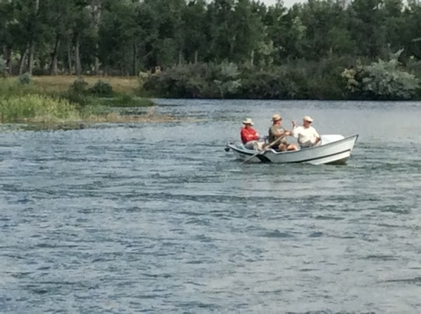
Well, folks, we made it to Montana in the early evening. Jack checked out the Bighorn River, one of the most famous flyfishing rivers in the U.S., and made his fishing plans for Thursday, and now we're in Cottonwood Campground in the flyfishing town of Fort Smith, Montana. Jack's in hog heaven.

Mileage: 131,303
Starting mileage: 124,375

State Count: 15 (Virginia, West Virginia, Maryland, Pennsylvania, New York, Connecticut, Massachusetts, New Hampshire, Maine, Michigan, Wisconsin, Minnesota, South Dakota, Wyoming, Montana)
Also Canadian provinces of New Brunswick, Newfoundland & Labrador, Nova Scotia, Quebec, and Ontario)

Sunday, July 6, 2014

Brunch Aboard a Mississippi River Paddlewheeler

We arrived at a county campground just outside of La Crosse, Wisconsin last evening (July 5th) that is situated on the La Crosse River. If you have been following all our blogs, you might recall from our trip to Lake Superior last fall that Jack fished the Bois Brule River and found out that early French explorers used that river to get to the Mississippi River. They did this by rowing upstream and then portaging a small tract of land over to the La Crosse River. The La Crosse flows into the Mississippi at a town called (you guessed it) La Crosse and that is where we planned to travel on the La Crosse Queen, a paddlewheeler, up and then downstream. The French explorers paddled all the way up to present Minneapolis/St. Paul and down all the way to New Orleans. Maybe we will do that sometime. (Note from Carol: Oh, yeah??!!)
Carol at our campground beside the La Crosse River.
  We got up early this morning so Carol could go to church while Jack figured out where the Queen was moored and find a place to park. La Crosse is a beautiful town with a gorgeous river walk.

Most of the Protestant churches in La Crosse are Lutheran. Carol attended this one. The folks were very welcoming.

Carol along the Mississippi River walkway with the La Crosse Queen in the background
The La Crosse Queen is a unique paddlewheeler. It is seven years old and is the seventh ship to bear that name. Unlike many imitation paddlewheelers, the paddle wheels on this one actually propel the ship. The ship has two diesel engines and each drives one of two paddle wheels through hydraulic motors. Jack took these movies of the paddle wheels in motion.
The La Crosse Queen at the dock.

A bow-on view of the Queen. The main deck is for dining and the upper deck is for viewing.

The paddle wheels on the Queen. There are two paddle wheels and each are driven separately by a hydraulic motor attached outboard of each wheel. One wheel can drive forward and the other backward during turning. While not as efficient as a modern marine propeller, these paddle wheels make a pleasing sound and look great underway. See the movie.
We signed up for this trip a long time ago and that gave us prime seating in the dining room and first in line for the delicious buffet. We both had mimosas (champagne and orange juice) and a cup of coffee while the ship got underway.
View of the dining room while ship is loading.

Carol and Jack toasting. Note name place cards. The buffet serving area is just off Carol's right arm. Our view of the river is on her left.

Our trip up river was pleasant. The river was high and flowing at about three knots. The Queen managed around three knots over ground against this current. We saw three bald eagles and a large tow (tug boat and barges). One of the ship's officers served as a tour guide and gave us history of both sides of the rivers, bridges, locks and the town. Very entertaining.
A bald eagle perched nearby and let everyone have a great view before flying off.
The tour guide told us about a war memorial in the park so we had to take a look after our voyage was over. The memorial was dedicated in 1918 to commemorate vets from World War 1 and the Spanish American War. A plaque made out of steel from the USS Maine commemorates the loss of that ship and her crew. In addition there is a Spanish cannon built in 1787 which we presume was captured during the Spanish-American War.


The captured Spanish cannon. Click here for more information.

Remember the Maine.
After our tour, we decided to start our drive to Montana. We are now stopped for the night at a motel in Worthington, Minnesota. Lots and lots of corn and other crops growing in the plains along with a new crop of wind generators everywhere. Great job, America! Let's minimize our dependence on Arab oil imports.

Friday, July 4, 2014

Soo Locks, Michigan

  
Carol at Brady Park. A laker is exiting locks in right background. RoadTrek parked on left.
Click here for a panoramic view of the laker.
At first we were disappointed in having chosen the 4th of July for the day to tour the Soo Locks in Sault Ste Marie, Michigan. From 10 to 12 am the city held a parade to celebrate the 4th of July, right when we wanted to tour the area. So Carol worked in our motel room until 11am and then we went grocery shopping. Around noon we headed to Sault Ste Marie. It was a beautiful sunny day and the parade was over. We had no trouble finding a parking spot just downstream of the Soo Locks. To our pleasant surprise a big laker was just leaving the locks as we pulled in.
Laker exiting Soo Locks. Tug is resupplying the ship as both are underway.
Those ships are big! Stood on end, some of the largest ones would almost be as tall as the Empire State Building. Around 7000+ ships pass through these locks each year (which are open only 9 months due to the freezing over of the Great Lakes). So on average 26 ships pass through these locks every day. And today, the 4th of July, was no exception. We saw 5 ships pass through the locks in two hours. There are four locks and all lift (upbound) or drop (downbound) each ship 21 feet. The locks are HUGE and crowds of people watching the ships passing through are impressive. The largest tankers (1,005.5 feet long by 105 feet wide) are designed to just fit in the largest lock. The clearances on each side of a ship look like no more than 6 to 9 inches. The locks all work on gravity so there are no water pumps involved. The gates are kept closed during the filling and emptying cycles, and opened only when a ship enters or leaves the lock. Flooding and emptying the lock is all handled by flow valves in the bottom of the locks.
Carol approaching Soo Lock Park.
Ship entering lock downbound from Lake Superior.
Ship is now inside lock. Gates are closed and water is being let out downstream.
Ship is now down in lock 21 feet. Downstream gate is opening to allow ship to pass out of lock.
Click here for a movie taken from inside the visitor center.

This is a cool place! We took lots of pictures and movies, and then got something to eat (hamburgers in honor of the 4th of July!). We then decided to head for La Crosse, Wisconsin to get a head start on that 10 hour drive. As we write, we are in a motel in the north country of Michigan a few miles east of a small town called Manistique. Surprisingly all the motels in this rural area are full. As we back peddled to find a room in one small motel, we found out why. The Chippawa indians have a casino nearby and folks here want to celebrate the 4th of July in style.

Stay tuned; on Sunday we plan to have brunch on a Mississippi River paddlewheeler as she makes her way up river between Minnesota and Wisconsin.

Our Time in Lac-Mégantic

One other interesting encounter with the authorities that I forgot to relate in the last blog occurred at the quiet US-Canadian border crossing in Maine on our way to Lac-Mégantic. We pulled up to the border and were greeted by a smiling black man, who wore a name badge that looked African. Before we said a word or gave him our passports, he looked at us and said, in lightly accented English, “You must be Jack and Carol.” We were stunned into silence for a moment, and then I replied, “How did you know that?” “Oh, that would be telling secrets!” he said. He gave our passports a cursory look and waved us on through, smiling all the while. We pondered various explanations for our reputations preceding us to the border (including the thought that the policeman who had stopped us earlier had called ahead to warn them!). We strongly suspected our friend Pierre had a hand in it, which proved to be the case. Pierre is a retired attorney, well-known in this area, and had apparently called the border to alert them!

Shortly after our arrival at Helen and Pierre’s house, after hugs all around as reported in the last blog, we skewered and grilled some shish-kebabs and made a salad for supper. We set an extra two places for their daughter Melanie and her friend Mathieu, who were arriving around 9 or 9:30 pm, on their way to Maine for a few days’ holiday. They showed up as expected and we had an enjoyable and companionable meal outside on the porch. The conversation turned to French occasionally but Helen would quickly bring it back into English for our benefit—very gracious of her. It amazes me that Helen can go back and forth between the two languages so easily. Both of their daughters are completely bilingual too. (FYI, Helen is the sister of our friend and Oriskany neighbor Lewis Hopkins, and was a classmate of Carol’s from Mary Washington College back in the late 1960s. We discovered each other through Lewis and have become good friends over the past several years. She married Pierre 30+ years ago and has lived in Quebec all that time. Jack and Pierre also enjoy each other’s company very much. We always look forward to spending time with them.)
Melanie and Mathieu with his vintage VW Westfalia camper.
The next morning we had breakfast, outside again since it’s turned very warm especially for Canada, and then Melanie and Mathieu took off on their vacation. Helen and I share a love of horses and she had scheduled a ride for us at Auberge d’Andomède, a charming country guest house that offers riding and gourmet dining packages and where she occasionally works as a horseback guide (and sometime photographer). Her friend Lisa, an American with a summer place nearby, joined us for the ride. Pierre and Jack planned to stay at home and take advantage of the lake’s cool waters.

When we arrived at Andomède, after figuring out which horses we were supposed to ride—not so easy since most of the horses at this stable are Canadian breed horses and look a lot alike!—we tacked up and headed out on the trail. The trails here are beautiful, going through pristine streams, old rail beds, fields of wildflowers, and beautiful views. The three of us had a canter or two where the trail allowed. My horse, Angel Queen, is apparently part Arabian, like my little horse at home, Nula. I was surprised when Helen told me she was about 20 years old, as she was rarin’ to go! Fun times! The little knitted caps on the horses are to keep the flies off their ears--they work great!
Lisa and I on our ride. The wildflowers were beautiful!
Helen's horse was a prime example of the Canadian breed, like the majority of Andromede's horses.

It was getting late when we got back to Lac-Mégantic. Lisa had houseguests waiting for her at her house. She and her husband Ed kindly invited us all over to their place for dinner the next night.

Our boys had given up on us and were having leftover salad on the porch when we drove up. They regaled us with stories of their day, kayaking on the lake (with lots of suspected made-up details, like how Jack saved Pierre's life when a great storm appeared...). We cooked out on the grill again (pork chops) and ate on the back porch this time, with the lake sounds as background. A delicious maple syrup pie, a specialty of the region, was dessert. Another great time of good food and hilarious conversation.

The next morning Helen gave Jack and me a tour of the aftermath of the horrific train accident that struck this town almost exactly one year ago. We were dreading seeing the damage, because when we were last here we’d had a nice tour and lunch in the charming little downtown area and we had pleasant memories. All that is gone now, along with 47 people who were killed that terrible night, many of them young people. The damaged downtown area is still contaminated with oil that spilled from the many overturned train cars. The whole area is fenced off and a guard gate is manned 24/7. The amount of damage to the center of town from the huge explosions and fire is almost unbelievable. So many buildings are gone, or are declared uninhabitable and boarded up. Basically the town is being rebuilt in a different place. The shockwaves from that accident are still being felt by everyone here and will be felt for many, many years to come.

The accident scene of burned, overturned train cars in Lac-Megantic right after the accident (taken from internet)
The scene today, with fenced-off disaster area and ongoing clean-up. Train tracks have been moved.
(Ironically, a similar accident occurred in Lynchburg, Virginia in April, when a train carrying crude oil derailed in the downtown area, starting a fire and causing a partial evacuation of the town. Fortunately there was no loss of life that time. Numerous other recent derailments/fires of this type are shining a spotlight on the increasing hazards of transporting crude oil from the Midwest and Western states to refineries all over North America. Some evidence points to the fact that the shale crude oil now being shipped by rail, mostly from North Dakota, is much more volatile than other types of crude and that is the reason for so many explosive accidents with fires. Most communities along the rail lines are not aware of the dangers, like Lac-Mégantic…)

Back at home, Helen and Carol decided to go for a swim in the lake—chilly at first but it felt really good! Then it was time to get ready to go to Lisa and Ed’s lakeside cabin for dinner. We met their friends, who are visiting from Maine, and had fancy hors d’oeuvres outside by the lake—they have a beautiful lakeside property—and a delicious dinner in the cabin, topped off by a fresh Maine blueberry pie. Another lovely warm night and great company. (Unfortunately, we all forgot cameras so no photos from Lisa's place.)
A refreshing swim in the lake! Jack stayed ashore to take photos.
Seems like our time at Lac-Mégantic went all too quickly. Wednesday morning we had breakfast on the porch, packed up the RoadTrek, and said our fond farewells to Helen and Pierre. Hopefully it won’t be too long until we meet again.
Farewell to good friends as we get ready to hit the road again.
Our plan is to take two days to drive across Quebec and Ontario to Sault Ste. Marie (pronounced “Soo Saint Marie” meaning “rapids of St. Mary,” referring to the big rapids on the St. Mary River), really two towns with the same name, one in Canada and the other in Michigan, connected by the huge International Bridge. The Soo Locks here is the busiest canal in the world in terms of tonnage. We hope to see some of the 1000-foot laker ships pass through the locks.
Sault Ste Marie seen from the International Bridge as we wait in the border crossing line.
 We just arrived this evening in Sault Ste Marie after a relatively uneventful two days drive (and no border-crossing incidents!). Tomorrow is the Fourth of July, so we’re not sure what that will mean for touring the Soo Locks. Stay tuned….

Tuesday, July 1, 2014

From Chéticamp to Lac-Mégantic (We Should Have Learned French…)

We stayed at Chéticamp Outfitters, a very comfortable B&B on Cape Breton Island in Nova Scotia, for two nights. As mentioned in the last blog, we arrived at night in the fog. We had a yummy breakfast in the dining room the next day, starting off with homemade blueberry muffins, and then pancakes! (Yay, we finally get the pancakes we’ve been looking for!) Veronique, the owner, is a VERY lively Acadian woman and fills us in on the background of her lodge (which started out as a hunting/fishing lodge) and the area. Chéticamp is considered one of the Acadian capitals of the world and is therefore mostly French-speaking. After the French Acadians were expelled by the British from the current-day Canadian Maritimes in the Great Expulsion of the 1700s some of them settled here, an area that was not colonized at the time. (Others ended up in Louisiana and became known as Cajuns there.) Chéticamp is known for its Acadian music and rug hooking and I’m really hoping to hear some music while here. The other people at the breakfast table are friendly folks from Connecticut and we enjoy finding out about their travels over breakfast.
Cheticamp Outfitters
View from Cheticamp Outfitters front porch.

It became obvious that our first day here was going to be a rainy one. Marc and Lynne set off early to hike the famous Skyline Trail but were discouraged by the rain setting in and soon came back to our cozy rooms, resolving to try later. Jack and I gave up easily and resigned ourselves to a quiet day inside reading, editing, and drinking tea. (Life can be so hard…) We went into town for lunch and some exploration and found out the music schedule for the evening, making a plan to come back for that.

We had supper in our rooms (rotisserie chicken and salad) and then Marc, Lynne and I headed out afterwards to listen to music. (Jack wasn’t feeling great and stayed behind.) The bar at the same restaurant where we ate lunch was advertising free traditional music. A young fiddler and an older woman on piano played (very well) old-time fiddle tunes. From what I’ve been able to learn, the Acadian music of today is a blend, incorporating French-Canadian tunes with very old Scottish and Irish fiddle tunes (Cape Breton is heavily Scottish). A teenage girl danced to one song—very reminiscent of our “flat-foot” dancing back home! A pleasant evening…
Acadian music.
The next day dawned with excellent weather for the continuation of our drive around the island. The road around is called the Cabot Trail and is a part of Nova Scotia known for its EXTREMELY scenic beauty. It was breathtaking, with cliffs overlooking the ocean. Marc and Lynne wanted a second shot at the Skyline Trail hike so we stopped at the parking area for the trail head. Jack and I weren’t feeling like a hike, so we poked around the area and chilled in the RoadTrek while they hiked. Lots of people were at the trail head, taking advantage of the good weather. On their return, Lynne and Marc reported a spectacular hike, and had lots of great photos to prove it.


Lynne and Marc share a scenic kiss on the Cabot Trail.

Then we shoved off for Ingonish, a little town on the Cabot Trail, on the northeast side of the island. We are staying at another little two-bedroom cottage by the water, and we find it with no problem and move our stuff in. It’s clean and comfy. After a little rest, we decide to drive around the town  harbor and check out the Keltic Lodge, which we can see directly across the harbor from our cottage. The Lodge is a famous resort here since the 1940s, owned by the provincial government of Nova Scotia, set on a scenic (everything is scenic in this part of Nova Scotia!) peninsula. The buildings are impressive. We take some photos and then sit in the lounge and have a snack and drinks while listening to a pleasant guitarist/folksinger. Lynne and I both have a brief emotional meltdown when a couple gets up to dance to “their song”—it’s their 55th anniversary! The boys just laugh at us!
SeaBreeze cottage in Ingonish.
Click here for a panoramic view.
Carol, Lynne and Marc at the Keltic Lodge.
Click here for a panoramic view.
Click here for an inside panoramic view.
The restaurant in the main lodge doesn’t have availability for supper so we try another restaurant that we saw in a different part of the resort. They seem to be out of a lot of things that we try to order, but the food ends up being pretty tasty. After supper we call it a night.

The next day, Saturday, is a long driving day, heading for Saint John, New Brunswick, to drop Lynne and Marc off at Lynne’s cousin Don’s house. We arrive about 6:30 pm to a warm welcome and some delicious fish chowder and blueberry pie made by Don’s wife Beth. They will stay in New Brunswick visiting Lynne’s family for a few more days (her mom was Canadian from New Brunswick), while we head west toward Montana—with a few stops along the way. Jack and I spend the night at a lovely large park near the center of town, designed by the same person who designed Central Park in New York City, Don tells us. It has a comfortable campground and this gives us a chance to set the RoadTrek bed back up and get back into camping order for the rest of our trip.

The next day was another long driving day—we head first to Quebec for a few days’ visit with our friends Helen and Pierre. We love visiting with them and their charming house on the shores of Lake Mégantic, so anytime we’re near there, we try to stop for a couple of days. They are always so generous with their lovely piece of paradise. We choose a route that takes us back into the states, driving across Maine, and then back into Quebec. The strict customs/border agent at the Maine border asks us about what fruit and produce we have on the RoadTrek. I confess to a couple of apples in the refrigerator, but forget about an orange in there. The agent comes into the RoadTrek and finds the lone orange and lectures us sternly, saying that if the agriculture inspector had happened to be here, he would have given us a $300 fine! Oops. I didn’t tell him about the bag of 6 or 7 clementines tucked into our secret hiding space. I don’t think we will do that again. He was mean! I had visions of him bringing out the clementine-sniffing dogs!

We have one other run-in with the authorities closer to the Quebec border, as we pass through a little Maine town. I spot the cop hidden in the brush on my side just as we see the 25 mph sign. A minute later we see the flashing lights and Jack pulls over. To my chagrin, Jack immediately goes on the offensive with the young policeman, saying that he had slowed down as soon as he saw the sign and scolding the cop rather severely. I’m thinking, “Bad strategy here.” (I usually like to use tears rather than hostility.) The cop keeps his cool however and asks to see driver’s license, insurance and registration. We finally manage to defeat him by using the “confused old person” strategy. I slowly sort through the big pile of scraps of paper in our glove compartment, repeatedly asking Jack, “Are you sure you put the new registration in here?” After about 5 minutes of a fruitless search, the frustrated cop says, “What’s that?” I say, “It’s a registration but it’s from 2011.” “I’ll take it,” he sighs, and he goes away for a while. He finally comes back, gives us a warning and lets us go on our way, cautioning us to watch our speed. Ah! We’ve actually used that strategy previously with good effect.

Pierre welcomes Jack with a hug.
We arrive at Helen and Pierre’s around 4:30 pm, to a warm French welcome! It’s great to be back in this relaxing spot, one of our favorite places…
Happy to see Pierre and Helen again!

Helen and Pierre's deck overlooking Lake Megantic.