Friday, July 18, 2014

Fishing the Missouri River with Pelicans

A lot of the Missouri River doesn't look like the same river Lewis and Clark traveled. As you move downstream from the town of Three Forks, there are four dams which are used to generate electricity and provide irrigation to crops and food for the cattle some of us eat. The Great Falls that the Lewis and Clark expedition had to portage around are now topped by a major dam that feeds electricity to the city of Great Falls and surrounding areas and provides irrigation water for crops and cattle.

On the surface, dams look like a great idea, and to be honest I wouldn't be writing this post if it had not been for the Holter Dam that created nearly 40 miles of fine trout water that I talk about later. But if you are old enough, you might remember that Arizona Senator Barry Goldwater fought hard and won for the building of the controversial Glen Canyon Dam on the Colorado River, that now provides water to all those golf courses and folks living in southern Arizona where once there was just a desert. Here is what Barry Goldwater said in 1988, many years after the Glen Canyon Dam was built: “What have we done to this beautiful desert, to our wild rivers? All that dam building on the Colorado, across the West, was a big mistake. What in the world were we thinking?”

As a trout fisherman fishing the Top 100 trout streams in America (according to the Trout Unlimited organization) I have witnessed good and bad things about dams. In the Catskills of New York I found legendary trout streams dammed and the water piped to New York City for drinking water. I have also seen a dam built on the Jackson River which destroyed miles of great trout water to prevent flooding of the papermill in Covington, Virginia. This was a dam that was partially sold on the idea it would create a great tailwater recreation area for trout fishing, until the landowners fought court battles to prevent fisherman using these trout waters. I have also fished great trout waters like the tailwater from the Yellowtail Dam and the tailwater from the aforementioned Glen Canyon dam. As an American and a conservation-oriented trout fisherman, I hope our politicians will always do a proper cost benefit study and that the "cost" will always include the damage to the environment, including all the critters and people who live in and love that environment.

With all of this in mind, Carol and I traveled to Wolf Creek, Montana so I could fish the Missouri at the tailwater of Holter Dam. After stopping at two fly shops for information and fishing supplies, we headed to the campsite at the base of the dam.

Here is one of the flyshops we stopped at, Rich's Tackle, in a little shed in Rich's backyard in the small, friendly town of Three Forks. In addition to giving great information and letting us take this photo, this likeable owner sold us flies for $1 each. I would later pay $2.50 each to resupply the ones lost on this river. (After Carol urged him to stock up on more of Rich's flies... will he never learn?)
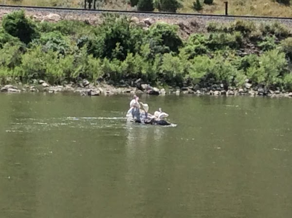
Along the dirt road to the dam campground we spotted these white pelicans resting on a big rock in the river. Pelicans are a good sign that there are a lot of fish in the river.
Just before we reached the campsite (in the background) we came upon this herd of Rocky Mountain big horn sheep coming down for a drink of water and perhaps a handout from the campers.
Off to our right we spotted this gal, who was obviously the lookout for the herd.
Wow, these guys can climb straight up a rock cliff, as we try to make room for this oncoming pickup.

Here we are at the bottom of the Holter Dam. Guides with their boats put in just above the camp. The chair in the foreground is from another camper. It is definitely NOT ours. I do not flyfish sitting down.

We signed up to stay two nights at the campsite so I could be sure I had enough time to catch at least one trout. When we arrived it was early afternoon and it was HOT. I could not see any trout rising and other fisherman indicated that the caddis flies start coming out of the water in the late afternoon and evening. So I spent most of the afternoon readying my gear, then donned my waders and headed for the river. A number of other trout fisherman were already on the stream and a few trout were rising for insects. I fished for awhile and hooked into a large fish. He was there for a moment and then was gone. When I reeled in, both of my flies were gone. (I had rigged with a dry fly and a dropper.) He had broken my line. I realized that my leader was too light. He had broken 3-pound test leader. Not much I could do about it, as that's what I had.

During the evening, I fished further downstream. I had lots of strong strikes, but each time the trout broke off my leader or the dropper. Carol snapped this picture of me in the middle of a cast.

After losing so many fish, I decided to go back to the RoadTrek and see if I had any stronger leaders or perhaps beg for one from the other trout fishermen. I found a stronger leader and tied on the smallest dry caddis fly imitation I had with me. I think the size was a number 20 (as determined by the hook size). Armed with this new set-up I headed back downstream just after sunset. Trout were rising everywhere. Four pelicans were fishing nearby. As I studied the dimple patterns the trout make, I noticed one that was consistently rising and had a very large tail (you can often see the dorsal fin and tail of a rising trout as he turns to head down after taking an insect either on or near the surface). So I cast to this trout several times. On one cast I must have successfully cast into his lane. I could not see my tiny fly but he rose near where I thought my fly should be. So I raised my rod and set the hook just in case. After a 10-minute fight with several gigantic leaps (him, not me), I landed a rainbow trout that was at least 21 inches. It was the largest trout I have caught so far on this trip.

Later as I was telling the story of my catch to Carol, I remembered that Lee Wulff who had an amazing career of fly fishing had created the idea of a 20-20 club. To become a member you had to catch a 20-inch trout (or larger) on a number 20 fly. I'm not into trophies and you won't find any of the trout or large bass I've caught over the years mounted on my walls. As gently as I could, I released this beautiful hard-fighting rainbow, while he was in the water, so someone else can catch him again. By the way, Lee Wulff's wife Joan was also an amazing award-winning fly fisher and has a fly fishing school named after her.

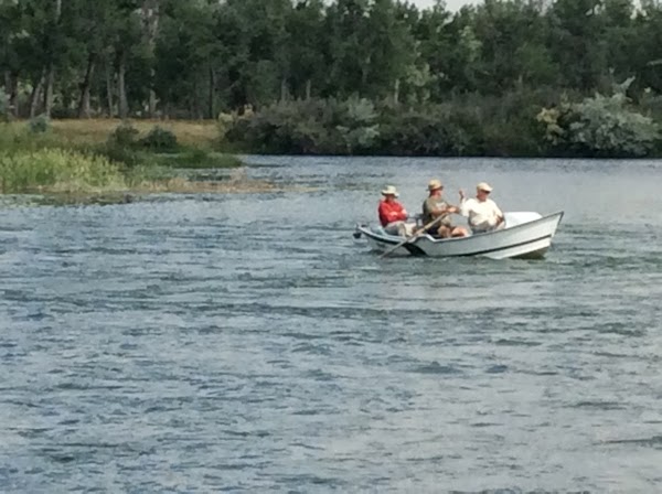
The next morning we decided not to stay another evening at the campsite. It was getting kind of crowded. We headed for Helena, with wifi and cell phone service, so Carol can do some work on her new book, while I rest up, catch up on my blog entries, and plan for the next river, the Smith River, not too far away. As we were leaving I snapped this picture on Friday morning to show how crowded the Missouri River can become on the weekend.
The rainbow trout I caught was just off the left bank that juts out into the water. A vehicle is visible on the road next to the bank.

Fishing the Gallatin River during Lightning

The Gallatin River is one of the three rivers that create the Missouri River near a town appropriately named Three Forks, Montana. The other two rivers are the Jefferson and Madison. All three rivers were named by Lewis and Clark. I have already fished the Madison in several places. The Jefferson is not on my Top 100 list, but two of its tributaries are. So the Gallatin, which is about 125 miles long, was entirely new to me and I wanted to scout it before fishing it.

As it turned out, our journey to Henry's Fork, the Yellowstone and Grand Teton National Parks took us along the Gallatin River. So I got to see it from a roaring large stream near Bozeman to a small stream near the park entrance town of West Yellowstone.

I fished the Gallatin in three spots on our way back from the Tetons. The first spot I picked was in the canyon area where the river is about 25 feet wide. The wind was blowing hard through the canyon making fly fishing difficult. I fished about a 200 foot section without a bite. The stream was beautiful and I was the lone fisherman as far as I could see in either direction.
Carol took this picture from our RoadTrek parked along highway 191. That's me in the river in the center of the photo.
 I decided to try another location downstream and just out of the canyon and south of the the town of Big Sky. This time I did a little better. This section is wider and I saw a few trout rising to take aquatic insects. The trout seemed to be taking nymphs near the surface so I rigged with a surface caddis fly and a dropper fly (a dropper is a fly tied to the shank of the floating dry fly by a one to two foot long small section of leader called tippet)  that imitates an emerging caddis larva. After numerous casts I finally hooked one trout who almost immediately got off. In the process of  getting off, that trout put all others off their feeding. I moved downstream but did not see any more rising trout.
This is the second fishing spot on the Gallatin River. Again, there were no other trout fishers in sight.

It was late afternoon so Carol and I headed downstream to an RV site along the lower part of the Gallatin. After settling in I immediately headed over to the river to see if any trout were rising. To my pleasant surprise trout were rising along the entire length of tailwater from a heavy rapid upstream. This is big water and we passed many rafting outfitters upstream. Fortunately it was late in the day and no rafters were on the river. It was also overcast and overcast evenings are the conditions that caddis love, to emerge from their larval state into a winged sex-crazy flying insect. I caught three rainbow trout on surface using caddis flies. The trout ranged in size from 7 to 10 inches. Carol came down and snapped my picture just as I was about to land one. Carol stayed for awhile and then told me she saw lightning and suggested I get out of the river. Now this placed me in a dilemma. It is very hard for a fly fisherman to leave waters when trout are rising. So I easily reasoned that I had a fiberglass rod that could not conduct electricity so I could continue fishing. Which I did. Still it made me wonder about fly fisherman who use the new graphite rods. Anyway, it started pouring rain and the engineer in me started saying you know that holding a wet rod while standing in the water is setting yourself up for a shocking experience. So I got out of the water and headed back to the RoadTrek. Carol got a good laugh out of it because I didn't have my rain jacket on. Still I wonder, had I had my rain jacket on, would I have left all those rising trout, or just chanced it?
The stream here is about 150 feet wide. I waded out about 15 feet so I could cast where the trout were rising. The trout I have on is about 10 inches and fighting like wild rainbow trout do.
Before we left the next morning, I got up early and headed back over to the stream. It had stopped raining and I managed to catch three more rainbow trout. By the way, graphite fly rods do conduct electricity and so does a wet fiberglass rod. Still, the chances of getting killed are much higher every time we drive a car or our RoadTrek...

Wednesday, July 16, 2014

Henry's Fork, Yellowstone and Grand Tetons

Sorry for the radio silence over the past couple of days. We were lost in the wilderness! Not really lost, exactly, but just outside the reach of cell signals and internet access, doing some primitive camping. We drove from Montana into Idaho, because Jack wanted to show me his favorite trout stream, Henry's Fork of the Snake River. He had fished it some years ago with his fishing buddy, appropriately named Bud, and caught the biggest trout of his life there, 24 inches long. In particular he wanted me to see the huge spring where the river bubbles out of the ground, in the middle of a volcanic caldera 23 miles in diameter. Trout spawn in Big Spring and you can see groups of them (no fishing though!). It was a charming spot.
This is a flashback photo that we forgot to put in earlier--our first glimpse of the Rockies on the drive to Montana, always a thrill.
Big Spring, where Henry's Fork of the Snake River begins.
 We looked at some other stretches of Henry's Fork while in Idaho and did some birdwatching in Harriman State Park, spotting the rare trumpeter swan, a good one for our life list!
Trumpeter swan, found here and just a few other places in the world.
We camped in Idaho and next morning drove into Wyoming. We were very close to Yellowstone Natl Park but had just about decided not to go into the park this time due to the negative things we'd read about how bad the traffic is and how overcrowded it is this time of year. We'd visited Yellowstone some years back, in September, and absolutely loved it, so it was hard to pass it up. We decided to "drive by" and check out the lines, and discovered that they didn't look all that bad, so we ended up making a plan to drive through Yellowstone into Grand Tetons National Park (which conveniently adjoins Yellowstone) and try to find a camping spot in Grand Tetons (which can be hard to come by, as this park is also pretty crowded this time of year).

It worked out for us! Yellowstone had a lot more traffic this time than it did during our last visit, but it wasn't "terrible." We didn't run into big traffic jams like those I'd read about, but we stayed away from Old Faithful and the other popular spots where the parking lots looked full. Yellowstone is gigantic, and there are plenty of places to get off the beaten path. And it's just SO DANG COOL!! This has to be my favorite national park. It's got jaw-dropping scenery, scads of wildlife, the most bizarre natural wonders ever seen anywhere (and for Jack, some of the world's best trout streams). In our short drive we saw a bull elk, hundreds of bison, mule deer, American white pelicans, sandhill cranes, antelope. And the geyser basins and steam vents are always spectacular. (Old Faithful is just one among thousands of geysers in Yellowstone.) The big fires that burned through here not too many years ago left lots of dead tree skeletons, but natural reseeding has created new trees everywhere. We stopped at many spots and walked, and looked, and photographed. This blog is going to be mostly a photo album of the past couple of days of sightseeing, since we took so many pictures and it's hard to leave any out!
Close encounter of the bison kind. (Note our rearview mirror on the left.)

Norris geyser basin--an otherworldly hike through steam vents, geysers and weirdly colored hot pools. Click here to view Jack Video of the basin.. 

The Firehole River, one of Jack's favorite trout streams. Note steam vents nearby. Click here for a panoramic view of the Firehole
Jack at the Fishing Bridge in Yellowstone (fishing not allowed off the bridge anymore).
Lewis River Falls, on the way to Grand Tetons.
Carol watching the Lewis River as it heads for the Snake River. Here are some of the tree skeletons from earlier fires in Yellowstone.
After oooing and ahhhing our way through Yellowstone, we drove south into Grand Tetons Natl Park, past our namesake Lewis River and its spectacular falls and rapids (actually I think it was named for Meriwether Lewis). This is our first time to the Tetons. We had glimpsed the mountains from Idaho and had a clue that they would knock our socks off when we saw them up close, and they did. This park is definitely all about these mountains--you can't escape them and you don't want to. The high jagged teeth of the Tetons just rise up from flat land--no foothills at all! Volcano-born and glacier-carved. They don't look real! Beautifully clear lakes reflect them throughout the park. After taking photo after photo, Jack and I started competing for the artsiest photo--lying flat on our backs or on our tummies to get some flower or shrub into the shot.


Artsy view of Grand Tetons with storm. Click for a panoramic view.

View from Grand Tetons National Park marina.

Artsy photo by Carol.

Artsy photo by Jack (he was supposed to level up these horizons in his photo app but forgot)
We didn't see a lot of wildlife in Grand Tetons, although supposedly the wildlife is here, but we really enjoyed looking at this place. There are 12 glaciers in the park, and we were able to see two of them lodged way up on the sides of mountains. We drove the scenic loop and it has to be one of the top scenic drives we've ever made.
Falling Ice Glacier is the U-shaped blob of ice just under the vertical black crack (which is filled with old lava)---one of 12 glaciers in this park.
This is Grand Teton, the highest peak at just under 14,000 ft.

We got one of the last campsites in the Park, at Lizard Creek Campground, which is supposed to be one of the top 10 campgrounds in the West, according to the campground host, who may have been slightly biased. But it was wooded and quiet and on a lakeshore with a view of the mountains; no electricity, cellphones, or showers, and no generators allowed... but only $11 with our National Park Senior pass. (I still can't believe that for just $10 senior citizens like us can purchase a pass that gets you into any national park for free for the rest of your life, not to mention major discounts off campgrounds on any federal lands--has to be the best bargain we've ever gotten.)
The Snake River and the Tetons, the last photo we took of these mountains. We want to be sure we don't forget them...

Hope you forgive the extreme number of photos this time... Next, Jack will regale you with his fishing experiences.


Saturday, July 12, 2014

Yellowtail Dam and Pompey's Pillar

We stayed another night (total of 3) at Cottonwood Campground. It's a comfortable spot, although management is a little disorganized. On Friday morning we drove around to see some of the sights and take some photos of the river put-in and the big dam that creates the lake and this excellent tailwater trout fishery. Turned out we were a little early for the dam Visitor Center (or maybe the ranger on duty was a little bit late getting to work!), but the gate finally opened and we got in. It's a nice, informative visitor center and the ranger was chatty and friendly. Jack got a great video looking down on the water coming out of the base of the huge dam. Very impressive, despite the fact that neither of us is a big fan of dams in general.
Click here for Jack's video
Back at the campsite Jack took it easy (recuperating from his hard day of flyfishing) and Carol worked all afternoon, finally finishing the edit of the book she's been working on for the past 4.5 months! Yay! Long book. A little drama took place in the late afternoon when a GIANT rig pulled in and tried to get into a space next to us that wasn't really big enough. That's part of the disorganization of this campground--it's very hard to tell where one campsite ends and the next one begins, so folks park sort of haphazardly. Jack ended up getting a funny picture of our little RoadTrek right next to this big rig--like David and Goliath!
Jack thinks our RoadTrek will fit inside this bus!
We had a comfortable night's sleep and departed on Saturday morning, heading (in general) toward the next river on Jack's list. We planned to stop at Pompey's Pillar on the way, a National Historic Site where Carol can get the park Passport stamped and we can see the only remaining conclusive physical evidence of the presence of the Lewis and Clark expedition. Here on an impressive rock formation by the Yellowstone River, William Clark carved his name and the date, and climbed the formation to see the view. He also wrote about it in his journal, so it's well-documented. His signature and the 1806 date are still there, along with some Indian pictographs and other people's initials and dates through the years. (Video surveillance now discourages people from adding their own graffiti...) Very cool. We are big admirers of Lewis and Clark and it was a thrill to be standing exactly where Clark stood all those years ago, admiring the same view (minus the vast herds of bison and elk he commented on).
Pompey's Pillar, named by William Clark for Sacajawea's little boy, who he called "Pomp"
William Clark's signature and date carved in the rock.
Next, we stopped in Billings to see a movie. (America--we both enjoyed this patriotic documentary that strongly counters the "I'm ashamed to be an American" trend. Some of the immigrant footage was classic.) Now we're docked at a KOA in the little town of Big Timber. Just received a sad email from our pastor, David Cox, telling us that a good friend back home, Hazel Deisher, passed away today. It wasn't totally unexpected (and she had said numerous times that she was ready to go) but we will miss her sweet spirit.

Tomorrow we drive down toward Grand Tetons Natl Park. Oh boy, BIG mountains. (So far we've been in the relatively flat part of Montana, but that's about to change...)

Friday, July 11, 2014

Big Horn River and Jumping Browns

We arrived in Montana around 5 pm yesterday (July 9th) and made our way to the first of 10 trout rivers that Jack wants to fish in Montana. The Big Horn River where Jack will fish is a tailwater of the Yellowtail Dam. Why name the dam Yellowtail, you ask? Well, let's go back to our entry into Montana while traveling on I-90. Unlike our entry into Wyoming on I-90 described in our last blog, a sign greeted us as we crossed over into Montana that said, "Welcome to Crow Nation." Indeed we were entering into the Crow Nation Reservation. The area on which the Yellowtail Dam was built was purchased from the Crow Nation and the dam was named in honor of a famous Crow Indian leader (very ironic that it's named for him, because he fought hard against this dam being built in their sacred canyon).

So what makes this dam so famous for trout fishing? Turns out that most dams with bottom releases release cold water that is within the temperature range that trout need to survive. But this dam not only releases cold water, its alkalinity is also ideal for the growth of aquatic insects  in such prodigious numbers that it can support a very healthy and fast-growing population of trout. Rainbow trout were introduced to the tailwater after the dam was built and they quickly flourished. Brown trout later found their way into this trout mecca from tributaries. Now the river supports impressive numbers of large rainbow and brown in the 18-20 inch range, with many much larger.

Of course Jack only has to catch one trout in this river to check it off his bucket list. So when we arrived in Saint Xavier we started looking for the river, as well as a place to stay. Turned out that this little village was about the size of Oriskany but with no place to stay. So we headed up river to mile 13 river access so Jack can see if he can wade-fish the stream. The river was obviously running high and was not wadeable. Jack had already researched and found a nice flyshop in Fort Smith near the dam which had guides and boats for fishing the river. So we headed upstream to the town and Jack signed up for an all-day guided boat trip down the river. Jack also bought his Montana Fishing License there and the folks told us of a nearby RV campsite.

Today (July 10th) we traveled back to Fort Smith so Jack could meet his guide. Carol took pictures and then returned to our RV campsite to work while Jack and his guide headed off for a day of fishing.
The little town of Fort Smith is mostly flyshops and cabins for trout fisherman.
Jack chose this outfitter because they had a great website.
Jack and his guide getting ready to go fishing.
Jack setting up his flyrod and placing his rain jacket in the boat. Jack says he brought his rain jacket as insurance that they would have a rain free day of fishing. (It worked!)
Carol making final inspection, to make sure everything is in order.


Jack's experience on the river: Curt, my guide, and I got in his boat just below the dam. There were many other guides and their clients climbing into boats. (This is a VERY popular river with trout fishermen!) The river is quite large however, so these boats scattered quickly.
Here is the launch boat site. The river is flowing from right to left. The dots in the water to the left and above are boats that have already launched and are headed downstream. This is a big wide river and the water level is high at 7,000 cubic feet per second. The water is crystal clear and cold.
The boats used by the guide can handle two fisherman (one in the front and one in the back) and one guide who handles the oars, netting the fish, and changing flies. With two fishermen in the boat, the guide is kept really busy. In our case, I'm the only fisherman so I am in the bow and the guide can concentrate on placing me where he knows the fish hang out. The bow of the boat has a seat, but the place to be is standing with your legs locked into a specially designed stand with a pan where you can strip in and shoot out your fly line. Curt explains that we need to rig for "nymphing" (nymphs are the larva of tiny aquatic insects that live in water) because the water is high and most of the fish are feeding on or near the bottom.

We traveled not more than 100 yards before I catch my first fish. It's a huge (18-20 inch) brown trout. Brown trout ("Browns") in the wild are really beautiful and are known for their hard fighting and deep powerful runs. But this brown is jumping out of the water, so I think it is a rainbow trout, which are more known for their aerial acrobatics. This one puts up a big fight and makes several powerful runs which strips line from the reel and makes my reel sing. Only when we get the fish close to the boat do I realize it's a brown. As soon as the guide puts the net in to get the fish, the brown takes off again and again. Finally the guide nets the fish, removes the hook and lets the trout slip back into the water.

I'm elated! I can now check off this river. But the action has just started. By the time we have traveled two of the thirteen miles of our trip, I had caught so many brown and rainbow trout in the 18-20 inch range that I lost track. Already my arm was playing out from casting and fighting fish. By the time we reached mile sixteen, I was a hurtin' puppy. We waded in several spots and I got several big fish in every spot. Wherever Curt told me to cast, I caught big fish. This is the most fabulous river I have ever fished. I've been on rivers where I caught a lot of fish, but never on a river where the average size of the fish I caught was 18-20 inches. (I did catch one brown that was about 7 inches long.).

So why are the trout so large in this river? The answer lies in the limestone found in the canyon walls surrounding the stream. Limestone keeps the alkalinity of the river at a perfect level for the aquatic insects to grow. With so much food in the water, the trout grow rapidly and reach a big size. Spring creeks like the ones found in the center of Pennsylvania also have perfect alkalinity. But the trout there are hard to catch because the rivers are small. So the Big Horn is like a huge spring creek with plenty of deep water where the fish can feed and hide from predators.

For more information and many pictures, see the Bighorn Trout Shop website.  This is the outfitter I used and my guide's name was Curt Olsen. Here are a few shots of the river I took later.

This shot was taken at the Mile 3 access point. A lone fisherman is trying his luck from the bank while two boats with guides float by,
This closeup shows a boat with a passenger in the back and a fisherman in the bow. The passenger has his or her hand crossed and is obviously not fishing. The fisherman in the bow is sitting down while casting. This is something I never do. I stand up with my legs hooked in so I can cast easily and spot when a fish takes my nymph. There is also less chance of hooking the person in the rear during a back cast if you are standing.

Thursday, July 10, 2014

Along the road to Montana


We scheduled some RoadTrek maintenance and stayed in Worthington, MN for a couple of nights, also so Carol could take care of a book editing deadline. Then we headed west on Tuesday morning, Montana or bust! At first we were mostly seeing farmland and prairie grasslands, for miles upon miles. Everything looks nice and green here, so they've apparently been having some rain. We entered South Dakota shortly after leaving Worthington and spent most of the day driving across the grasslands. We visited Mt. Rushmore and the Crazy Horse memorial just a few years ago, so we didn't plan on stopping there again. However, when we entered the SD badlands and saw the sign for Badlands National Park, we stopped, and were very glad we did.

South Dakota prairie. The perfume from the blooming grasses smells sweet!
We collect national park stamps in our little Park Passport book and the first visitor center we came to after leaving the interstate was for the Minuteman missile site historic park. For those readers who didn't live through the Cold War, this was a big thing--our deterrent to the Soviet Union destroying us with a nuclear first-strike was our armament of 1000 Minuteman missiles scattered all through this empty part of South Dakota, armed and ready to hit Moscow if we got the word that they had aimed a missile at us! Crazy, huh? Guess it worked, since we're still here.... At any rate, the National Park Service has preserved some of the sites, a control center for the "missileers" as they called them, and a missile silo armed with a (reproduction, not fully loaded!) Minuteman missile. Pretty cool.

Carol enters Minuteman missile site.


Reproduction Minuteman missile ready to go.

After collecting the Minuteman park stamp, we headed down to the Badlands National Park Visitor Center and got a map and some info on what we might be looking at. This is such a cool park!! The badlands just rise up out of the green prairie, looking like a moonscape, or a giant's crazy sandcastles.

Jack and Carol at first Badlands overlook.
We drove the scenic loop and took photo after photo, although as usual the photos don't do it justice. There's lots of wildlife as well. A bison herd roams free (although as we found out, they are actually fenced into a very large grazing area--50 miles long maybe--to keep them out of the surrounding ranchers' grazing areas). The pronghorn antelope, bighorn sheep, and mule deer go wherever they want. On our drive we saw several bison bulls at a distance, a small herd of Rocky Mountain bighorn sheep, one pronghorn, two huge prairie dog towns, and lots of birds.

The Badlands rise up out of the prairie like some phantasmagorical landscape...

Carol scaring herself again.
In fact we added a couple of birds to our lifelist here. We got close looks at several small burrowing owls sitting on fenceposts, watching the prairie dogs. We figured they must eat the smaller "dogs," but from Wikipedia research it seems that they actually use abandoned prairie dog burrows for their nests, and eat smaller animals that the prairie dogs scare up, like mice, voles and lizards. Then we saw an upland sandpiper sitting on a fencepost--long legs, long beak, looks more like a beach bird than a badlands bird. Great drive, great wildlife and scenery! Love this park!

This bison kept walking closer and closer to us. Note prairie dog on alert in foreground.

This Rocky Mtn. bighorn ewe walked in front of the van, to join a small herd of ewes and lambs on the other side.

We ended up near Wall, SD. We had been seeing billboards for the past 500 miles, at least, for Wall Drug--obviously a tourist hotspot, why we're not exactly sure--and decided we'd go there and look for a campground for the night. We'd seen these Wall Drug ads for years on various cross-country drives but never stopped till now. Wall Drug turns out to be a historic pharmacy, of all things to be a tourist hotspot. Through the years it's taken over the town of Wall with blocks of store buildings that sell and display pretty much everything (lifesize animatronic T-Rex, anyone?). Busloads of tourists flock in here. It's a pretty cool old-time town though. Still has the old town parking on both sides of the wide, wide streets. Very easy to park and walk around in. (Editorial note: Why did we lose the "downtowns" in our small towns and opt for malls?? At least we see them coming back in some of the small towns we drive through...)

Wall, SD downtown (mostly made up of Wall Drug).
We found a friendly campground a couple of blocks from Wall Drug and then walked over there to grab some supper--buffalo burgers! First we lovingly photograph them, then we eat them. It's the American Way!

On Wednesday we continued our drive toward Montana (passing the geographical center of the United States along the way). We entered Wyoming and stopped for lunch. Although we were in Wyoming for just a short time, we managed to go whitewater rafting, horseback riding, and fossil digging---all without leaving the Wyoming Welcome Center!! Wow! They have the coolest state visitor center we've ever seen!

Just a few of the "activities" at the Wyoming State Welcome Center. This last photo is a fossilized cypress tree found at a nearby coal mine. Even though it's turned to stone, you can still count the rings! (It was about 500 years old when it died, they say. Lived in this area gazillions of years ago, when the climate was much different?)

Well, folks, we made it to Montana in the early evening. Jack checked out the Bighorn River, one of the most famous flyfishing rivers in the U.S., and made his fishing plans for Thursday, and now we're in Cottonwood Campground in the flyfishing town of Fort Smith, Montana. Jack's in hog heaven.

Mileage: 131,303
Starting mileage: 124,375

State Count: 15 (Virginia, West Virginia, Maryland, Pennsylvania, New York, Connecticut, Massachusetts, New Hampshire, Maine, Michigan, Wisconsin, Minnesota, South Dakota, Wyoming, Montana)
Also Canadian provinces of New Brunswick, Newfoundland & Labrador, Nova Scotia, Quebec, and Ontario)